services
Geomatics: Maps, GIS, GPS, Remote-Sensing:
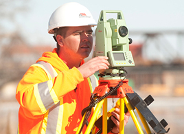
Geospatial or Geomatics engineering is the branch of science that deals with the collection, analysis, and interpretation of spatial information and data relating to the earth’s surface (land, seas, natural resources, and manmade features) – We at ICON cover all of that!
We offer tailored solutions to meet our clients’ needs from location maps for governments and businesses for inclusion in leaflets, advertising material, flyers and web sites; to walking guides, maps for travel guides, atlases and maps for signs and information panels:
- Printed maps of all shapes and sizes
- Web Maps
- Maps for Mobile
- Geographic Information Systems (GIS)
- Global Positioning System (GPS)
- Remote-sensing
- And many more